

Reflections on Water - Chapter 7, Riverlands
Chris Nicodemus & Katrina Meserve
Chapter 7 in our Reflections on Water series marks the first anniversary since we started writing these bimonthly chapters. ACT is also celebrating its 25th Anniversary in service to the North Country and we are fresh from the recent celebration at the Sugar Mill Meeting House in July. In the first year of Reflections, we looked at the many ways that water interacts with our unique northern New England geography to define our natural landscape, its beauty, its biodiversity and its vulnerability. For year two of the series, we will draw on those same observations and see how they relate to specific properties as well as the regional challenges that our greater community continues to face over time. The goal is to help inform policy and individual decision making that promotes both community vitality and a healthy and sustainable natural environment.
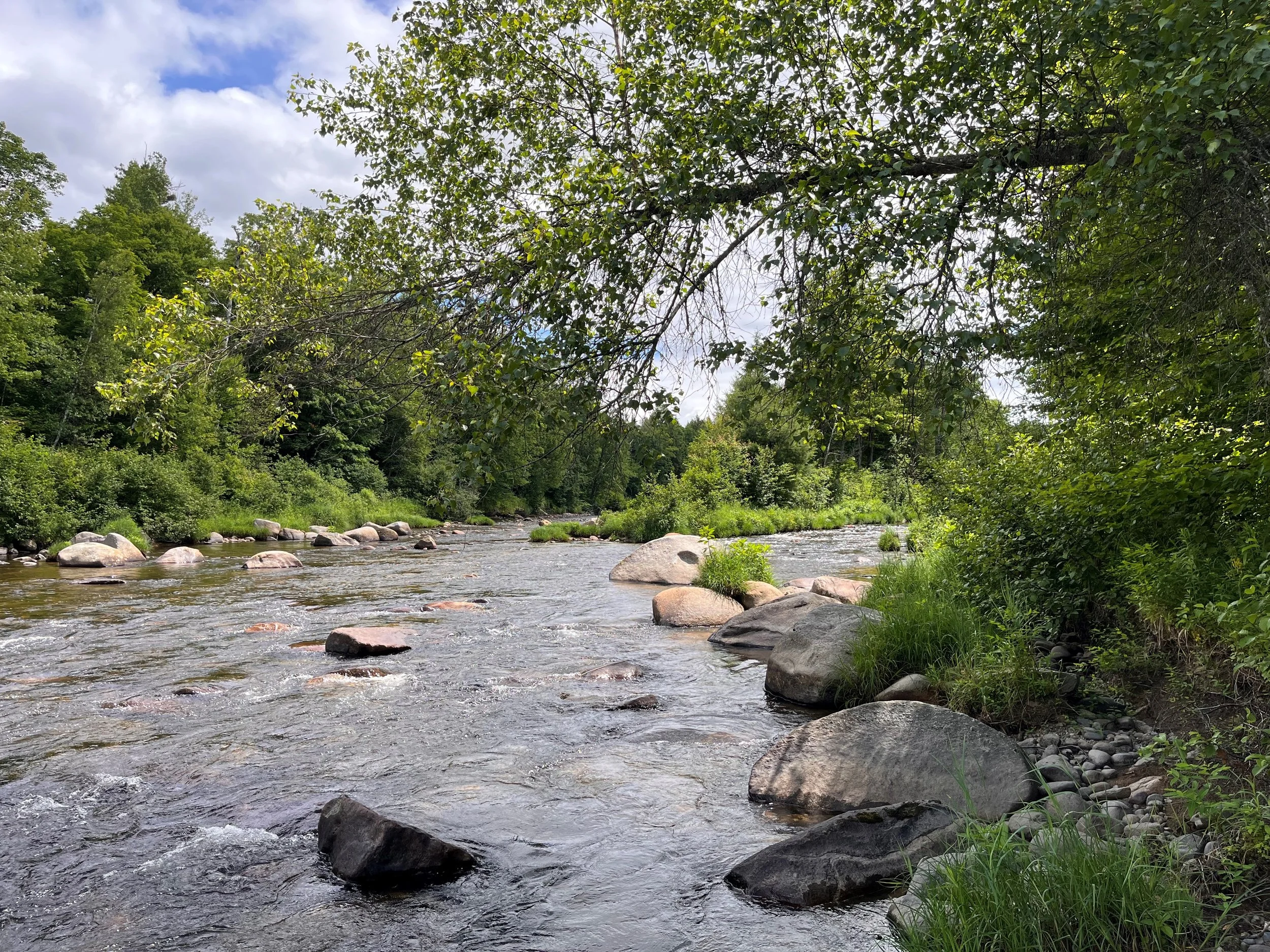
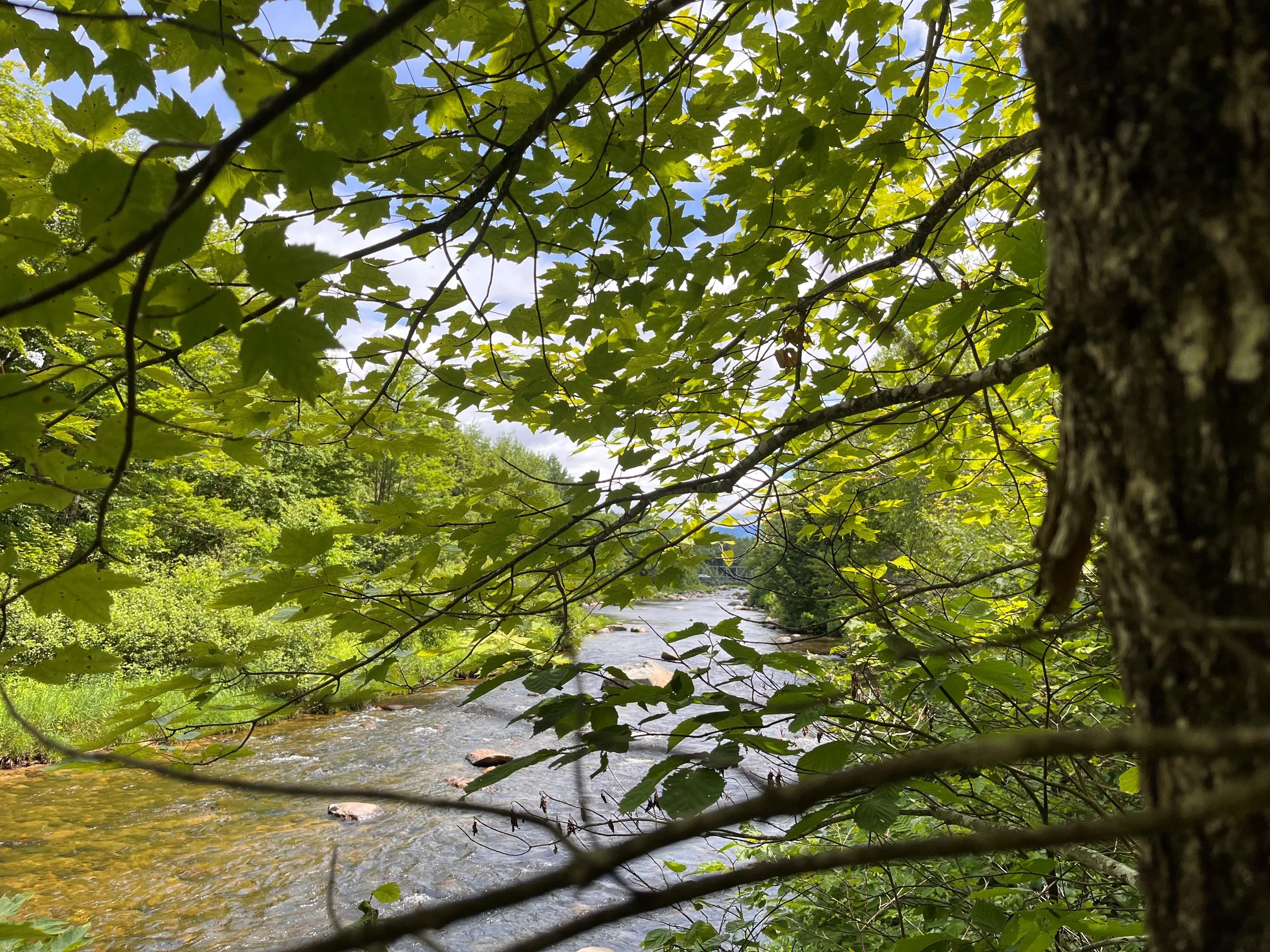
A major milestone acquisition for the Land Trust was closed in the Spring of 2025. The property known as “the Ammonoosuc Riverlands” contains more than 760 acres in Bethlehem. The parcel extends from the Prospect Street bridge at Wing Road for 2.5 miles downstream on the village side of the Ammonoosuc. The property sits near two additional privately owned riverfront conservation lands for which ACT holds easements and assures important riparian protection for the river though a large stretch of the river approaching the Littleton border in this western part of Bethlehem. This project was made possible because local community members recognized the opportunity, brought it to ACT’s attention, and then ACT’s staff, volunteer, plus local community members mobilized to prioritize the acquisition, find the necessary funding and complete due diligence on an accelerated timeline. ACT thanks all those who participated in supporting the purchase and as ACT Chair, I applaud the diligent effort of ACT staff and volunteers to expedite the process.

The property has been relatively gently used but does accommodate a major power corridor and is traversed by a snowmobile corridor. As a riparian floodplain with glacial moraines traversing it, it has a very high conservation value providing alternating upland and wetland forest protected lowland environments providing rich habitats for native flora and fauna as well as migratory visitors.
The property lies in the rolling valley of western Bethlehem bridging the area between early settlements at Alderbrook and those uphill to the northeast at Cherry Valley Road. The glacial topography of the valley is of historic significance being the subject of debate starting in the 1840’s. Notably, the 19th century natural scientist/ early geologist Louis Agassiz who is credited with originating the theory of Continental Glaciation visited Bethlehem in 1847 and recognized the ridges along todays Prospect Street sloping down between the Village and the River to be glacial moraines. This geographic feature includes the entirety of the Riverlands. Agassiz described the hills one crosses in travelling down Prospect Street from the Village as consistent with regional glaciation but erroneously suggested these glaciers retreated south toward the nearby heights of Mt Lafayette. [(Ref Agassiz, L., 1870, On the former existence of local glaciers in the White Mountains: American Association for the Advancement of Science, Proceedings, v. 19, p. 161-167] His influence brought attention to the region and refined understanding of the process of deglaciation but has been the subject of continuing debate and research by prominent geologists to the present period.
In 1930 Richard Lougee a Geology Professor from Columbia University documented the stages of the multiple glacial lakes that existed in the Ammonoosuc Valley during deglaciation and more recent studies identified the interruption in deglaciation during a multi-century cooling period that resulted in a stuttering local readvancement of the Continental Glacier over hundreds of years and contributed to the formation of the Bethlehem Moraines. The definitive work of Thompson, Dorian and Fowler [Ref: Deglaciation of White Mountains Geographie Physique et Quatenaire vol 53 1999] has settled overall understanding. The receding continental glacier in the region ~12,400 years BP and as the ice dam face shifted northwest, water trapped between the nearby Mountains and hills and moraines was released at progressively lower altitudes. The glacial Lake Ammonoosuc which originally extended from the ice face north and east past Twin Mountain, progressively lowered as the ice sheet retreated and its final stages comprised a shallow lake extending northeast from the property draining first across the eastern lowland and later shifting more westward across the Ammonoosuc’s current path by Alderbrook and down to the Connecticut Valley. Thus, the two final stages of Lake Ammonoosuc drained through the Riverlands, and the glacial sediments, fluvial deposits and water flow erosions sculpted the current land scape.

The Trust will be developing a stewardship plan over the next several years and that process starts with patience and observation. There is a great opportunity for interested volunteers from the community to participate in the process and provide important assistance to the Land Trust’s professional staff. I commend readers to look at the stewardship plan for the Cooley Jericho Community Forest on the ACT-nh.org website to find an example of a comparable Stewardship plan and appreciate the many different ways we will improve our understanding of the property over several seasonal cycles and also engage the community to help gather needed information and better appreciate the interests and preferences of the neighboring community as we formulate a detailed working plan.

The topography of the Riverlands is young in a geologic sense and has been heavily influenced by water both in frozen and liquid forms. Rich sediments, verdant wetlands and well drained uplands alternate across this landscape. The Power corridor creates visibility for the undulating glacial features where the forest is removed, and the many glens and ponds provide a rich wildlife habitat. Community volunteers will be needed to participate in the process of inventorying the hidden natural features, flora and fauna as well as examine the detailed cultural history and establishing how this land handles the fluctuating New England seasons. There will be an opportunity for education, demonstration, experimentation, recreation and reflection. We hope to foster a next generation of emerging citizen conservationists who will use this property as a resource to perpetuate these values.
Banner photo by EP Chow.
Photos by Chris Nicodemus