

Explore the wide variety of
CONSERVED LANDS IN THE NORTH COUNTRY
Much of the land ACT has conserved, both privately owned and ACT owned welcomes public use. As with any land, please respect the privacy and wishes of the landowners. Public use of private land is one of New Hampshire's greatest traditions - let's keep it that way!
Stay safe and have fun!
Many of ACT’s publicly accessible lands are multi-use, meaning besides hikers you might also see cyclists, snowmobilers, cross-country skiers, snowshoers, and hunters. Hunting is allowed on some of ACT’s properties; for more information please contact the ACT office. Below are a few ways to stay safe on the trails during hunting season:
1. Check hunting season dates; the NH Fish & Game website has the list easily accessible at: wildlife.state.nh.us/hunting/hunt-dates.html
2. Wear orange and get some orange on your pets too! A hat, vest, t-shirt, sweatshirt, and bandana all work great.
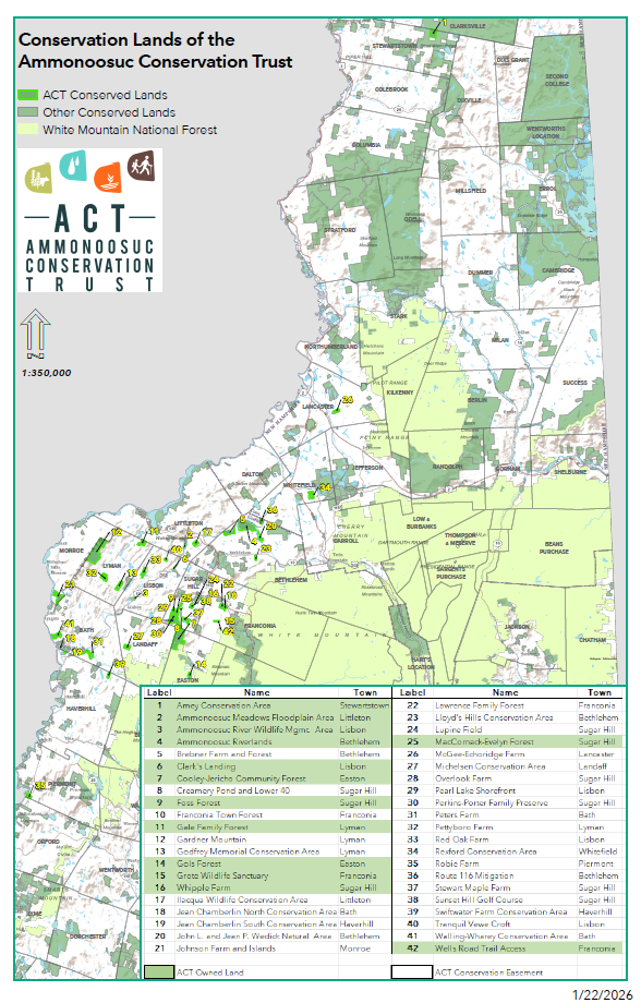
Below are descriptions and directions to ACT’s conservation lands that welcome public enjoyment. Please use caution when hiking on these or any trails. For more information on hiker safety visit http://www.hikesafe.com/.
Sugar Hill, NH
BRONSON HILL CONSERVATION AREA
Download a pdf of the trail map.
For trail descriptions click here.
Thanks to the generosity of several families, there are some great places to explore in Sugar Hill. Four connected properties, two owned by ACT and two privately owned and conserved with ACT, make up the Bronson Hill Conservation Area, over 600 permanently protected acres for public (and wildlife) use!
The properties officially named the Foss Forest, the MacCornack-Evelyn Forest, the Perkins-Porter Family Preserve, and the Overlook Farm are open to the public, but the latter two properties are privately owned so please respect the trails as well as the space around the landowners' home.
You are invited to visit and walk the trails through the classic hardwood forest, out to a great view of the White Mountains, and explore wooded wetlands. For more information about the Bronson Hill Conservation Area trails click here. The whole trail system can be accessed from Pearl Lake Road where there is a small parking area, please carpool whenever possible.
FOSS FOREST
This is the land that started ACT. Proposed for 10 house lots, today it is the keystone property of these four contiguously conserved lands. Foss Forest has trails on old skids roads and trails built by ACT volunteers and neighbors. Some of the trails lead onto the Perkins-Porter Family Preserve and into the MacCornack-Evelyn Forest. The Foss Forest may be entered from Pearl Lake Road where there is a small parking area.
MACCORNACK-Evelyn FOREST
This land is adjacent to ACT’s Foss Forest and was generously donated to ACT by the owners, Martha and Doug Evelyn and Martha’s brother Fred MacCornack. Martha and Fred wanted to follow their parents’ wishes to conserve the last of the family forestland. This was a significant gift to ACT adding to an already-conserved block of land and, with its rich forest habitat, it harbors a variety of wildlife.
This land had long been treated as common land by its neighbors, even though it was privately owned. ACT invites the public to enjoy the land by walking, cross-country skiing, bird watching, and hunting. No motorized vehicle use is permitted other than equipment used for forestry and trail maintenance. The MacCornack-Evelyn Forest may be accessed from the Foss Forest trail network.
PERKINS-PORTEr family Preserve & OVERLOOK FARM
The Perkins/Gibbs/Andrews family has been part of the Sugar Hill community since the late 1800s, and the current generation felt strongly that their family land should be protected for future generations to enjoy. Rufus Perkins, James Perkins Jr., and Louisa Porter made an enormous gift to the community of Sugar Hill by conserving and protecting over 420 acres of land over two properties, the Perkins-Porter Family Preserve and Overlook Farm, on Bronson Hill.
The properties are situated just below the summit of Bronson Hill and comprise a portion of the hill’s northern and eastern slopes. The land has open fields, forest, and several old cellar holes, including the foundation of Overlook Farm which was active into the 1920s. A network of publicly accessible trails crisscrosses the land and is maintained by the Perkins Family and a few dedicated ACT volunteers. The views from the two properties of the White Mountains, extending from the Presidentials through the Kinsmans, are unparalleled and breathtaking. Both properties can be accessed at the end of Dyke Road where there is a small parking area. They can also be reached by parking on Pearl Lake Road and hiking through Foss Forest.
Herbert G. Whipple Conservation Area

With the generous support of more than 110 community members, ACT completed the purchase of the Whipple Farm land in the summer of 2005. The 20 acre plot, the last undeveloped land from one of Sugar Hill’s early farms, is located on Route 117 just up the hill from Polly’s Pancake Parlor.
The land was cleared about 200 years ago and much of it has been maintained as field ever since. At its northern edge the property abuts a large beaver pond and marsh, most of which has also been conserved.
The land has not been actively farmed for many years but has been mowed to provide habitat for field nesting birds and other wildlife. Its preponderance of native grasses also attracts an unusual variety of butterflies and moths.
ACT mows the fields in the fall to maintain the habitat for field nesting birds and other wildlife that require grassland for foraging, shelter, and breeding. Native grassland is a disappearing type of habitat in the region as old farm fields are abandoned and grow into forests or housing developments.
ACT invites the public to enjoy the Whipple Conservation Area land for walking, skiing, snowshoeing, etc. The property can be accessed behind Polly’s Pancake Parlor with limited parking available in the back lot behind the restaurant and the lower lot along Route 117.
Franconia, NH
LAWRENCE FOREST

Download a PDF of the trail map
The Lawrence Forest in Franconia has it all: streams, wetlands, floodplains, young and more mature forest, and views, all accessible from foot trails. The conservation commission had long been interested in the property for its excellent recreational potential – there are mountain bike/walk/ski paths there, and the land is close to or adjacent to other town-owned properties including Fox Hill.
The land, now called the Lawrence Forest, had been on and off the market for many years before ACT and the Franconia Conservation Commission worked together to acquire it. The 115 acres of undeveloped land along Beaver and Meadow Brooks were finally purchased by the town in 2016. ACT’s Clean Water/Healthy Trout initiative identified the Lawrence property as a high priority for conservation because of its two cold-water streams, floodplains, wetlands, and presence of native brook trout and red-nosed dace, a fish species on the state watch list.
ACT invites the public to enjoy the Lawrence Forest for walking, mountain biking, skiing, snowshoeing, etc. year round. Lawrence Forest is a great addition to the Profile Trails network in Franconia. Parking is available at Fox Hill Park and at the end of Old County Road.
Easton, NH
Cooley-Jericho Community Forest

Stunning views await you in the Cooley-Jericho Community Forest.
The property encompasses 840 acres in the northwest corner of Easton, sharing boundaries with Sugar Hill and Landaff. Highlighted by the prominent ridge lines of Cole Hill and Cooley Hill, this upland forest is one of the highest-elevation and largest privately-owned properties in the western White Mountains. It is spectacularly beautiful and rugged, with stunning views.
You can explore the 6.5 miles of multi-use trails in the CJCF’s network in a handful of ways including hiking, mountain biking, snowshoeing, and backcountry skiing. Portions of two of the trails (Blue Loop and Red Trail) are also used by snowmobilers in winter. Please be aware - hunting is allowed by permission but not encouraged due to a higher volume of trail use.
Pets are welcome but please be a good trail steward and neighbor: clean up after your furry friends and use a leash when encountering others on the trail.
CJCF trails are accessible from several areas listed below by town:
Sugar Hill - Trumpet Round Road (easiest & most common access) and Dyke Road
Easton - Jericho Road Trail from Route 116
Parking for the forest is available at the end of Trumpet Round Road in Sugar Hill.
Looking to learn even more? Click the “Learn More” button ——————>

Click to download a PDF of the most up to date CJCF trail map.


Context map of the Cooley-Jericho Community Forest.
Thanks to TNC for supporting ACT’s expansion into Coös County - their grant support helps to increase land conservation capacity in in New Hampshire’s North Country.