

Explore
BETHLEHEM CONSERVATION AREAS
John L. Jr. & Jean P. Wedick Nature Reserve

Ammonoosuc River (Jerry Monkman photo)
John and the late Jean Wedick made a tremendous donation to the community of Bethlehem and the entire region when they permanently protected their land in late 2009. Their 120 acres on Wing Road in Bethlehem includes a mile along the Ammonoosuc River, which their conservation easement ensures will be open for public access – forever. This stretch of Wing Road along the Ammonoosuc is one of the most beautiful and easy to get to places along the whole river.
The Wedick land is unusually diverse with many interesting natural and historical features. Most prominently, it lies at the bottom of an ancient glacial lake. A former gravel pit offers evidence of our region’s geological past with layers of sand and gravel visible. The preponderance of gravel offers habitat for unusual plants and birds, and the turtles love it – the Wedick pond has a very robust population. In addition, an old railroad bed passes through the property – a segment of the former Mount Washington Branch of the Boston & Maine Railroad. This branch line ran from a station at the end of Wing Road to the base of Mount Washington, where guests could then board the Cog Railway to the summit of Mount Washington.

Unlike the riverfront, the main part of the Wedick property is not ordinarily open for public access. However, with prior permission, the Wedick family welcomes schools and other organizations to use the land for field trips. Contact Jennifer Wedick Penoso ([email protected]) if interested.
Brebner Farm & Forest

The property includes nearly 3/4 mile along the Ammonoosuc River.
ACT was very proud to work with Asa Brebner to conserve over 200 acres and nearly 3/4 mile of Ammonoosuc River shoreland at the end of Blaney Road. Asa's parents acquired the land in the 1960s. “I want my two boys to experience the same joy I had as a kid exploring that land,” Asa said.
The property had been a dairy farm, and its enormous barn still stands. While cows no longer roam the land, its woods, streams, wetlands, and old pasture hosts a rich range of plants and wildlife.
“It’s increasingly rare to find so much land in one ownership along the Ammonoosuc River, so we were really intrigued when Asa Brebner called us about the possibility of conserving it,” said ACT Executive Director Rebecca Brown. “Conserving land around our rivers and streams to protect clean water and wildlife habitat is one of ACT’s highest priorities.”
“I want my two boys to experience the same joy I had as a kid exploring that land.”
ACT is the North Country’s lands conservancy. Its Clean Water/Healthy Trout initiative aims to protect streams for people and wildlife. So far, ACT has protected the origins – or headwaters – of Salmon Hole Brook, a tributary of the Ammonoosuc River in Sugar Hill, and nearly two miles of shoreline on the Ammonoosuc River in Bethlehem, with its other conservation land bordering the river on Wing Road. This year ACT has also protected, in partnership with the Franconia Conservation Commission, over a mile of streams that flow into the Gale River.
“Brook trout live and breed on many – but not all – streams in the Ammonoosuc watershed,” Brown said “It’s good news when trout are present because they demand cold, clean water – they won’t live anywhere else. If streams are supporting native trout, that’s a sign of good water quality for people and wildlife. It’s our opportunity and challenge to keep streams healthy.”
As part of the conservation project, ACT partnered with N.H. Fish & Game, with assistance from ACT volunteers and the PAWS (Panther Adventure Wilderness Society) of Lisbon Regional School to assess the streams on the Brebner property. Fish & Game biologists and the students found baby brook trout, showing that the water quality was excellent. According to NH Fish & Game, baby trout use tributaries of larger rivers for cover from predators, and for thermal refuge – cold water – when the summer heats up.
“A whole host of wildlife from warblers to black bears use forested stream corridors,” Brown said. “They need streams with lots of trees and vegetation along their banks for foraging, cover, traveling, nesting, and refuge from heat.”
On the Brebner property, there is now a 200-foot wide buffer along the Ammonoosuc where trees will not be cut during future timber harvests. Similarly, protective forest buffers will be maintained along the small streams that feed into the Ammonoosuc.
“On properties owned by private landowners and conserved with ACT, we encourage strong stream protection,” said Brown. “We do the same on the land we own and manage. It’s the best practice for clean water and wildlife.”
Funding for the Brebner project came from the state’s Aquatic Resource Mitigation Fund, administered by the Dept. of Environmental Services, and from the Upper Connecticut River Mitigation and Enhancement Fund, administered by the NH Charitable Foundation. Both funding sources focus on conserving and restoring wetlands and waterways.
Bethlehem Wetlands
ACT agreed to hold a conservation easement on 40 acres along Route 116, next to a site that had been planned as a new transfer station for Bethlehem. The town itself violated state wetlands rules at one of its properties, and regulators required the town to protect wetlands and associate uplands elsewhere. The conservation area also protects important habitat for wildlife in the area, including black bear, deer, and wild turkey. As with the Lowe’s project, ACT is agreeable to working with towns where conservation is required to advance a goal of the community.
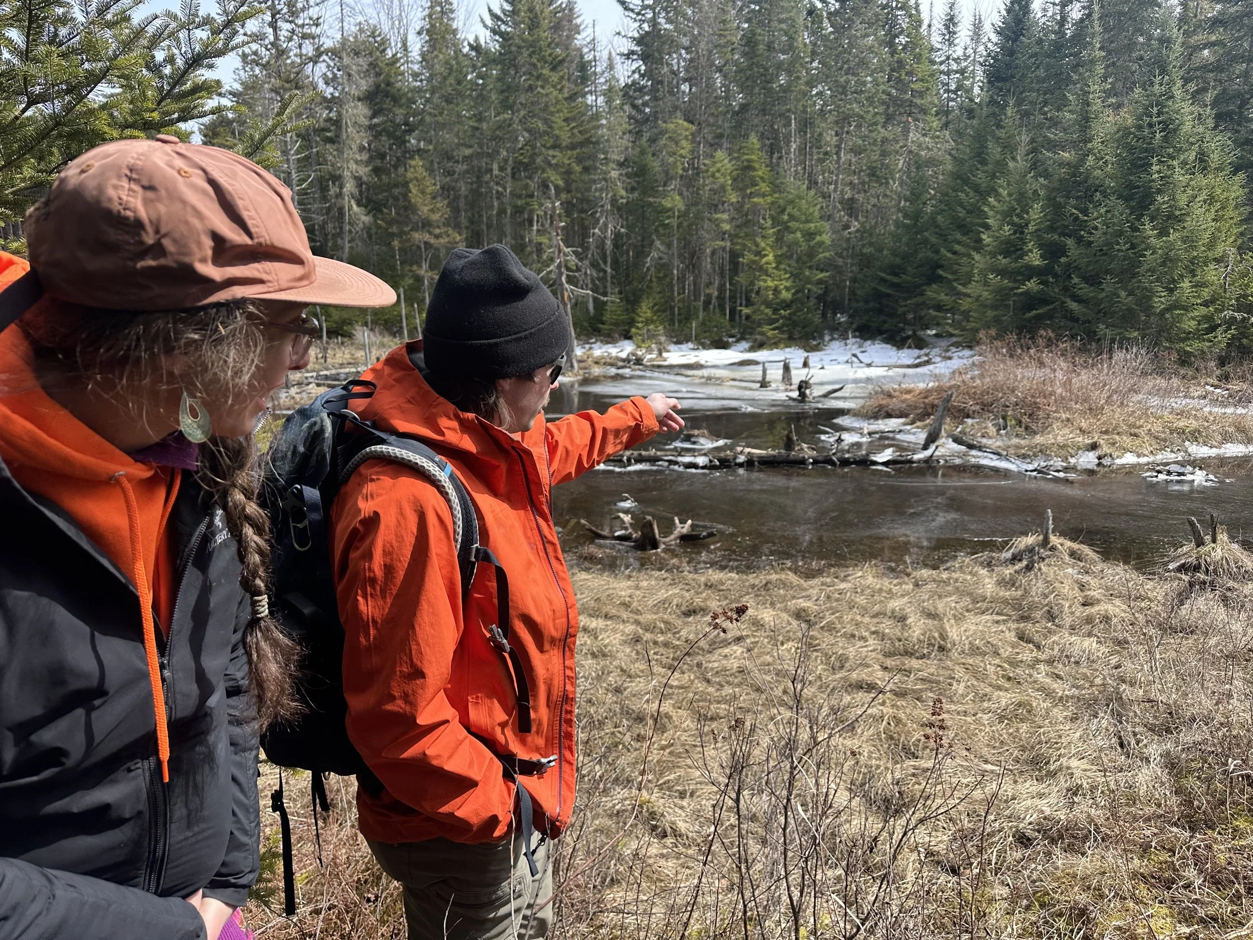
The Ammonoosuc Riverlands

The Ammonoosuc Riverlands consists of 761-acres located in Bethlehem, NH. The forested land tucked back behind 2.5 miles of river frontage on the Ammonoosuc River will become host to a network of multi-use non-motorized recreation for the public to enjoy year-round. After walking the property ACT’s Trails Manager, Conor, explains “the Ammonoosuc Riverlands is an excellent location for trail development. The proximity to the river, sweeping views of the surrounding hills, easy access, and diverse terrain will make for a unique and exciting recreation experience. ACT anticipates upgrading existing forest trails and building new trails specifically designed for sustainable use by mountain bikers, hikers, cross-country skiers, runners and snowshoers. Some trails will be specifically designed and reserved for mountain bikers, while others will be foot traffic only, to keep trail users safe and improve the recreational experience for everyone who decides to visit.”
These trails will be part of ACT’s careful management of the property which will include an in-depth analysis on the best locations for trails while maintaining the important wildlife habitat. ACT will also work alongside the snowmobile club regarding the existing snowmobile trail on the property. Because of their importance and the overall impact and value of this land, we will analyze the best way to manage the property keeping our four conservation values in mind, with wildlife habitat, outdoor recreation, and water quality being at the forefront of this property. In addition to these forest trails, ACT hopes to improve an existing riverside trail for access to fishing sites and swimming holes, as well as a put-in and landing for paddlers on the Ammonoosuc.
ACT will be working on protecting the water quality of the river with a 300-foot-wide buffer along the river frontage where no timber harvesting or alteration of terrain will take place. Along with this buffer, the wetlands and tributaries to the river will also be carefully protected on this property.
The Ammonoosuc Riverlands property is host to ecosystems of high importance within New Hampshire. The forest is a mix of spruce-fir and younger northern hardwood-conifers at higher elevations. The property contains widespread wetlands with intermittent streams draining the property and is scattered with beaver ponds. Outside the floodplain live uncommon red spruce, black spruce, and larch-mixed confer communities. This area is home to about 16.5 acres of the “Highest Ranked Wildlife habitat in NH” and about 326 acres of “Highest Ranked Wildlife Habitat in the Region ” according to the NH Fish and Game Department 2020 Wildlife Action Plan showing the importance of this property’s valuable wildlife.
Protecting this unique piece of land will ensure ecosystem resiliency within the North Country as it sits 2,000 feet away from an ACT property, 4,000 feet away from another piece of ACT protect land, and about 5,000 feet away from land conserved by SPNHF (Bretzfelder Memorial Park).
